Mount Rainbow is the highest point on the Moura Line at 297 meters above sea level it is situated between the
Calliope Range to the north and the Dawes Range to the south.
Trains often cross here because of the long climbs on either side of the loop that slow trains considerably.
The long grade down to Fry Loop towards Gladstone is covered by a 40km/h speed limit for block trains to help prevent
runaways. The line west to Moura follows Bells Creek down the west slope of the range crossing the creek three times
before reaching Dumgree Loop which is located on a flat shelf on the south side of the valley wall. As part of the loop
extension project in 2007 Mt Rainbow Loop was lengthened in the Up direction towards Gladstone.
Higher than normal Up Starter signals were installed to allow crews to sight them as the end of the loop is now on the
grade down the Calliope Range.
The map above shows Mt Rainbow Loop at the top of the range if you follow the line
to the right you will see the extensive earthworks needed to crest it.
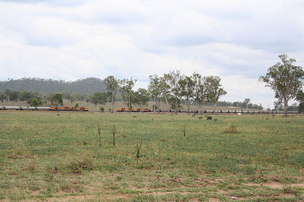
A rare event in 2007 two 4000 class trains cross at Mt Rainbow, the down train on the right is just passing the Up Starter
signals. Towards the rear of this train you can see some of the construction work for the loop extension.
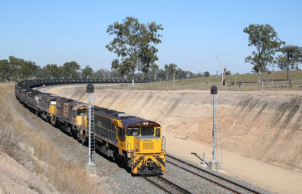
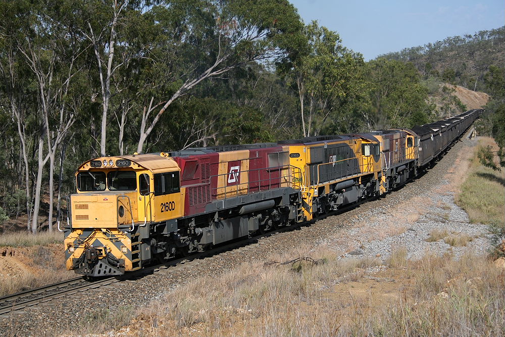
2265, 2159 and 2260 start down the long grade from Mt Rainbow Loop to Fry Loop, the old loop Mt Rainbow Loop was
straight and level with the Up Starter signals near where this train dissapears behind the hill. The driver has the speed
pinched back and the dynamic brake fans are starting to whine as the load starts to apply force to the locos.
14/08/07
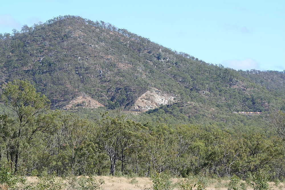
A loaded train heading towards Gladstone down the Mt Rainbow - Fry section just west of Mt Rainbow, taken from the Dawson
Highway it is an attempt to show the extent of the earthworks needed to build this section.
At the time of construction they were the largest ever undertaken by the Queensland Railways Department.
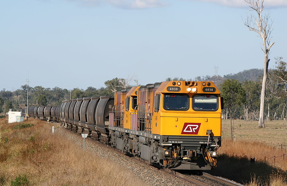
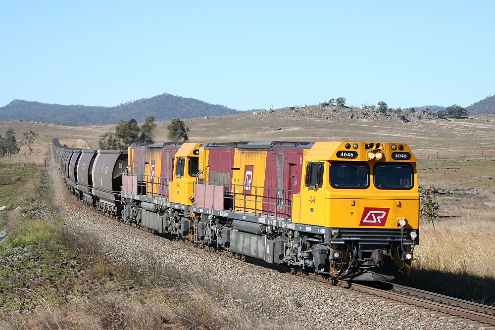
4038 and 4016 with 4024 fourty four wagons back lead one of the first regular eighty six wagon trains that the line was
upgraded for, out of the loop and down the hill after crossing with a loaded train.
It is common practice for empties to take the loop and loads hold the main.
This photo was taken from the Inverness Road level crossing at the western end of the loop the road will cross it twice
more at grade and pass under Bell Creek No2 bridge as they both snake through the hills between Mt Rainbow and Annandale.
14/08/07
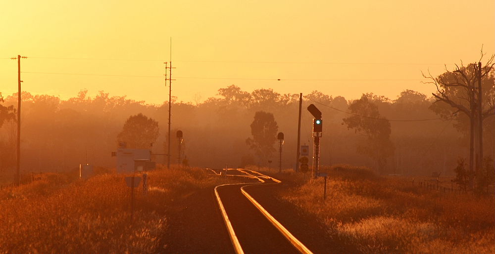
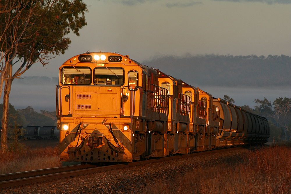
The sun has just cleared the horizon as 2205 and three other units shown below rumble through the fog on the approach
to Mt Rainbow.
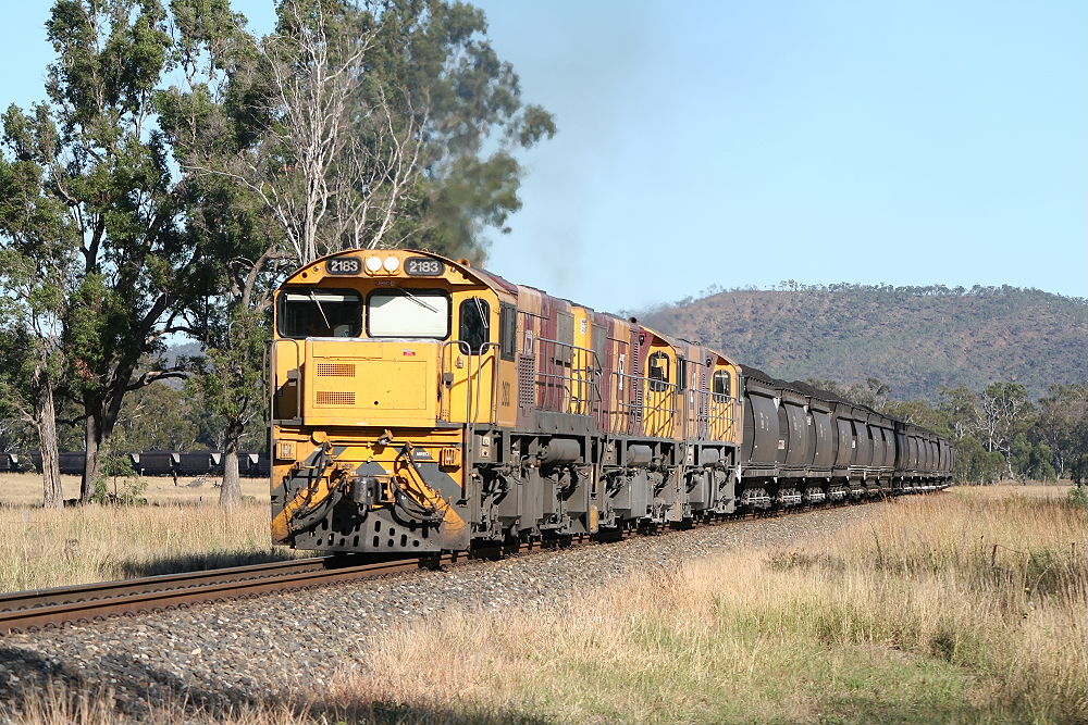
Same location looking west as 2183 leads a loaded train up the hill towards the loop. The first bridge over Bell Creek
is out of shot to the rear of the train and is not much more than a single cement span. You can hear trains grinding up the
grade for a good ten minutes before they arrive.
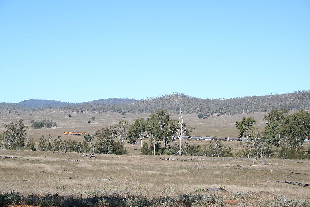
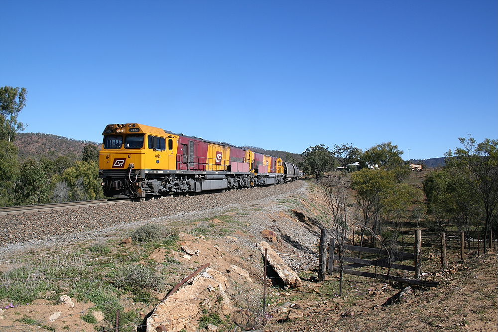
With the Calliope Range in the background and Bells Creek in the forground 4024 and 4027 keep a steady pace up the grade
about three kilometers west of Mt Rainbow.
12/07/07
The same section of track as the previous photo with an empty train for Boundary Hill.
13/07/07
A loaded Up train crossing Bells Creek No2 Bridge on its climb to Mt Rainbow, freshly painted 2163 in the middle
contrasts the previous paint jobs of the other units. The curve in the background is the location of the next photo below.
30/09/07
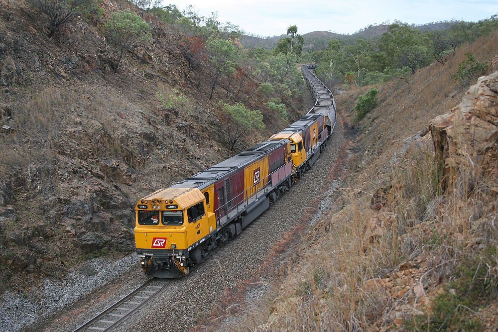
4004 heading west with a empty train through a series of cuttings in the most narrow section of the valley made by Bells
Creek. About ten wagons back is Bell Creek No2 bridge a large five span bridge allowing the line to valut across the creek
it follows most of the way from Mt Rainbow to Dumgree.
02/02/07
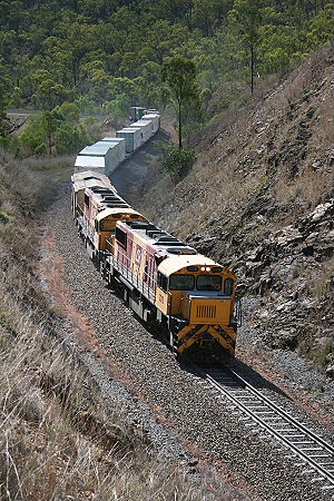
After crossing with the empty at Dumgree 6868 "meat train" makes light work of the grade with its short train.
The same train shown climbing the grade three kilometers south of Mt Rainbow is shown here about another five kilometers west
of that location approaching Inverness Road.
The building in the background is Inverness Station a cattle property that predates the railway.